Images
Project
Stefano Boeri Architetti (team leader), Rem Koolhaas, Petra Blaisse and Marina Perrot
Location
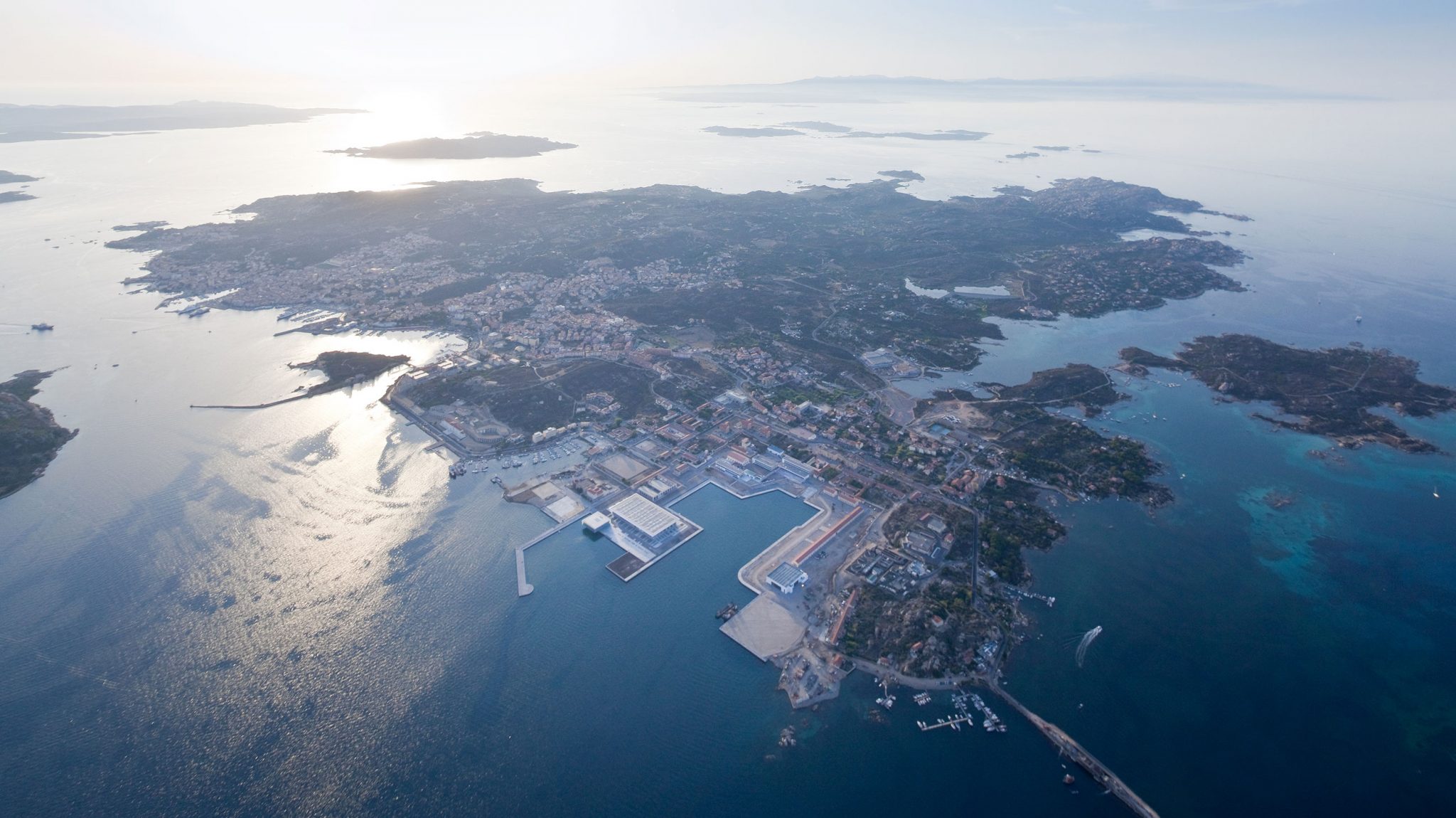
La Maddalena, Italy
Year
2009, 2014 - 2015
Type
Masterplan
Design team:
Stefano Boeri (Founding partner), Francesca Cesa Bianchi (Project Leader), (Team) Jacopo Colatarci, Moataz Faissal Farid, Julia Gocalek, Hana Narvaez
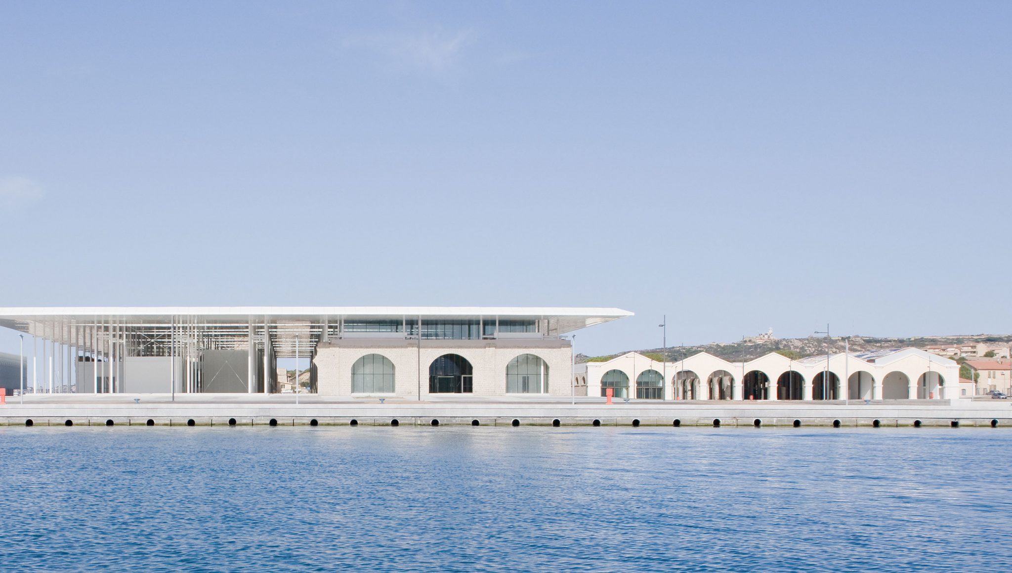
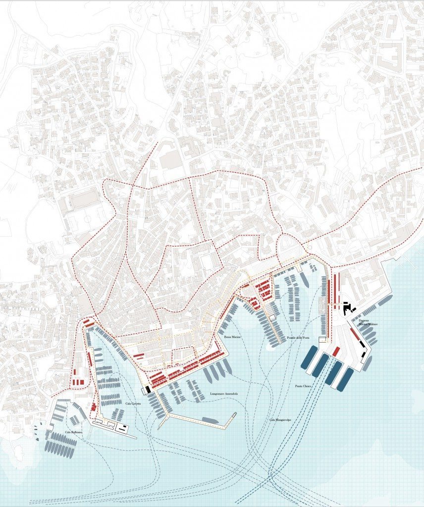
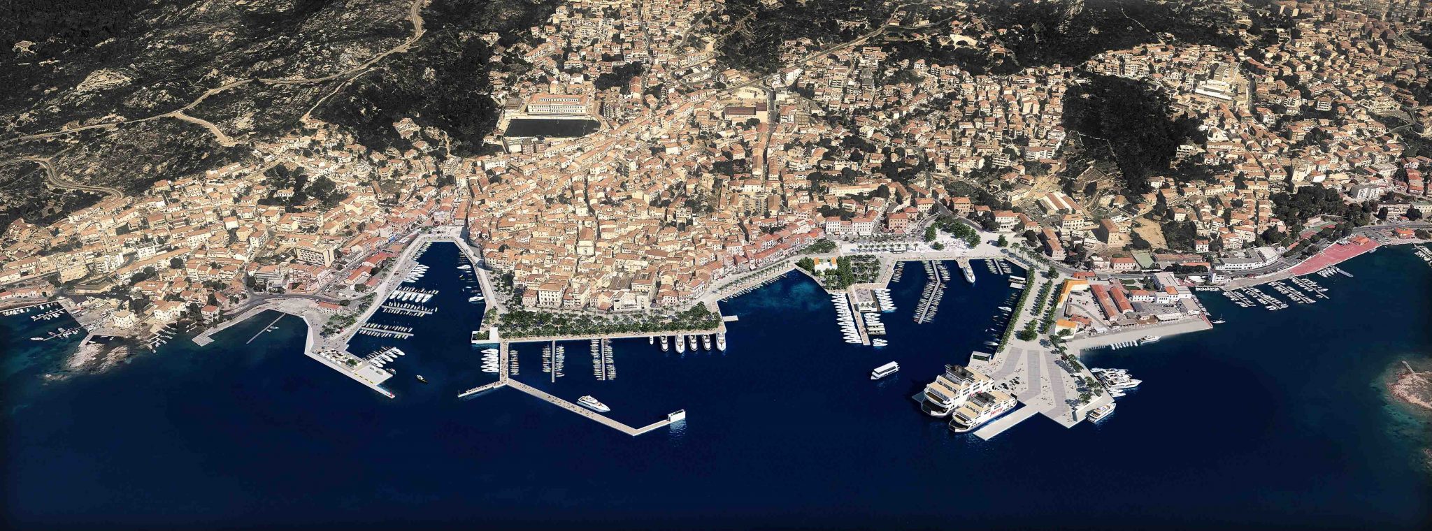
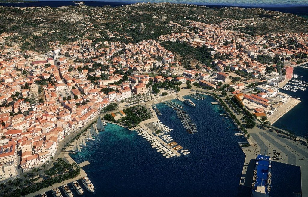
This intervention by Stefano Boeri Architetti sees the entire redefinition of the waterfront in La Maddalena, a small town of about 11,000 residents and the capital of the homonymous archipelago of islands located in the north of Sardinia in the province of Olbia-Tempio (OT). The whole process starts with the movement of the ferry terminal from its historic location on the Punta Chiara Amendola waterfront: an operation that frees up several areas facing the sea and thereby presenting a series of new and significant possibilities for the development and enhancement of the town’s waterfront. In particular, the urban planning programme by Stefano Boeri Architetti focuses on defining the uses and possible interrelations of spaces and activities that affect four main seafront areas in sequence, each associated with an evocative and conceptual idea. These are “The port” (.i.e the combination of pedestrian walkways and access to moored boats); “The road” (the main vehicular traffic artery); “The flows” (the whole set of pedestrian and commercial routes, spaces for parking and waiting, areas reserved for shopping, terraces and walks along the waterfront) and “History” (the perceptive and cultural experience linked to the crossing of the central urban areas of La Maddalena).
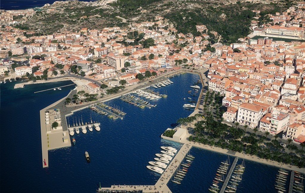
The client’s principal request concerning the port areas affected by the movement of the ferry terminal was linked to their urban consolidation and a serious rationalization of flows of traffic and people and the ways in which the areas were used. This objective could be achieved above all by means of their extension along the waterfront and providing a carefully thought-out distribution of services and urban furniture at the same time. The public request also envisaged the possibility of creating a new cantilevered quay on the waterfront intended for boat mooring: this would be a key intervention that would free up all the space of the existing quay to the overall benefit of the pedestrian flow.
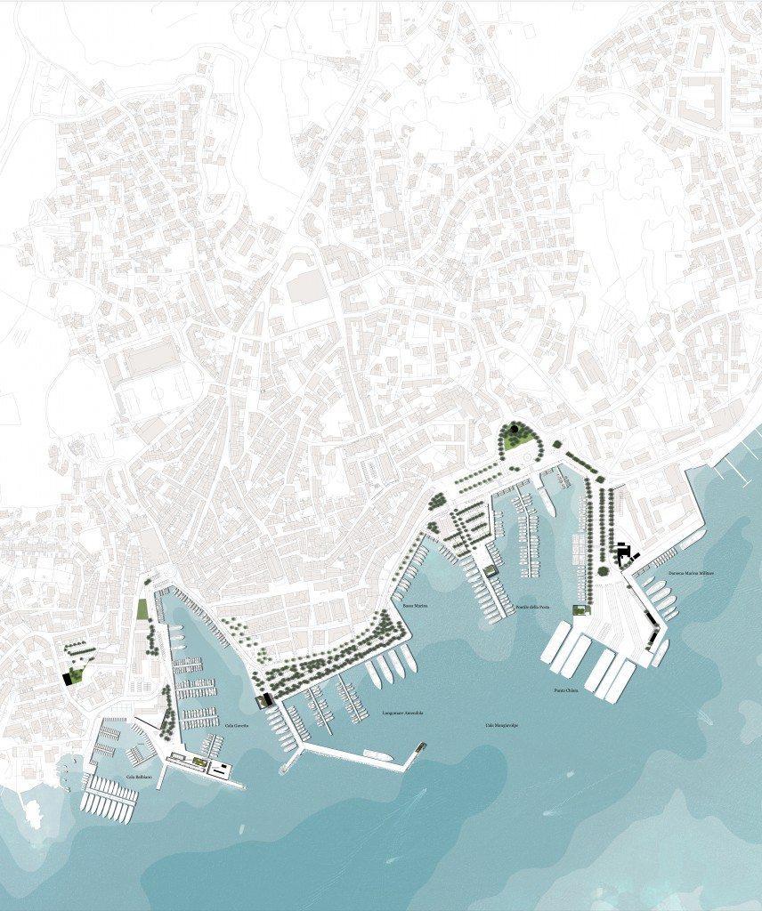
The design and project for a completely new port, closely integrated with the urban context and its principal traffic flows and routes yet also able to accommodate a total of 171 berths for small private boats is the initial result of such a request. The second area of intervention, focused on the road traffic network, was redesigned in its entirety in order to rationalize and strengthen the car parking and traffic system while at the same time not having a negative effect on the spaces reserved for pedestrian walkways and access to boats.
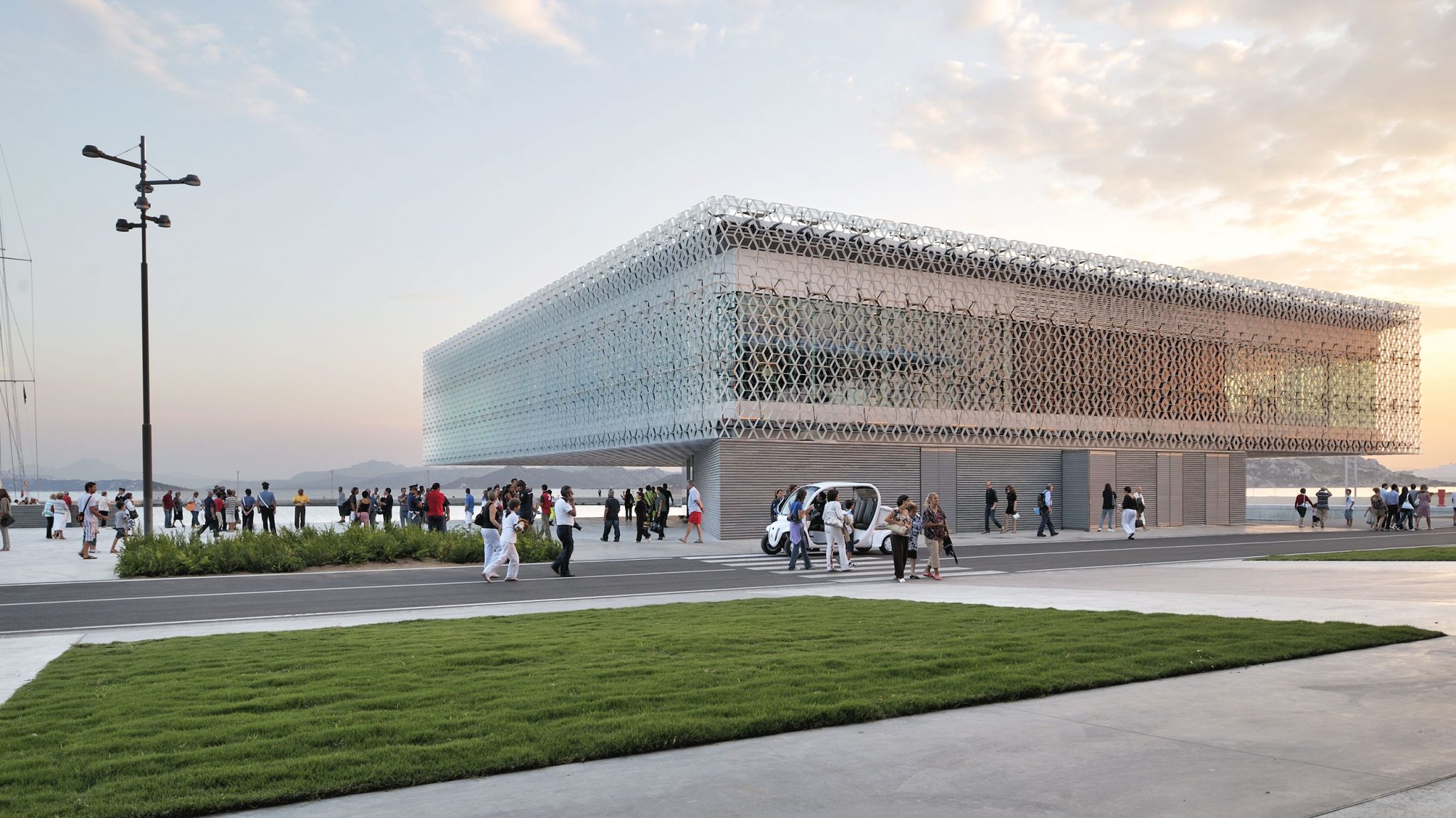
Two further actions were added to these initial interventions, aimed at establishing a new relationship between the strongly anthropized setting of the island’s port and the archipelago’s natural setting which boasts a number of qualities unique in the Mediterranean. In both cases, the project involves the construction of a series of special public places, specifically designed to reconstruct a relationship between individuals and the coastal and marine environments.
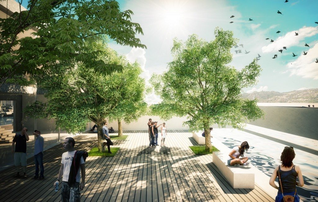
Central elements of this part of the intervention are the spaces scattered along the waterfront and christened “The rooms of the wind”: a series of closed but roofless environments, designed to host a rich selection of typically local plant species which characterize the vegetation found throughout the archipelago. Open to the wind, clouds, sky and the sea “the rooms of the wind”are primarily areas of rest and contemplation, but also places for sensory regeneration allowing users to come into contact with plant life and lose themselves in the aromas and colours of the archipelago.
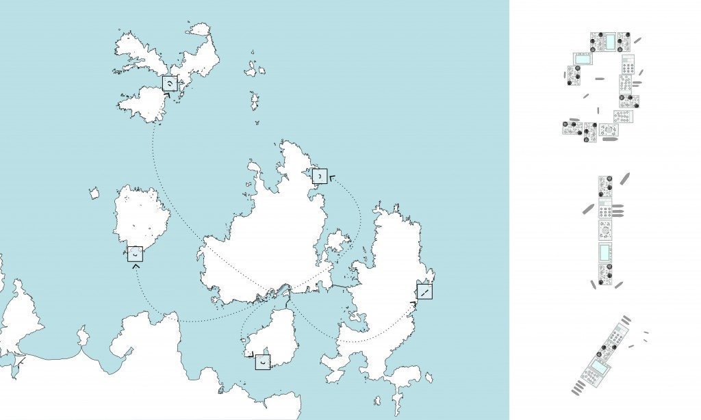
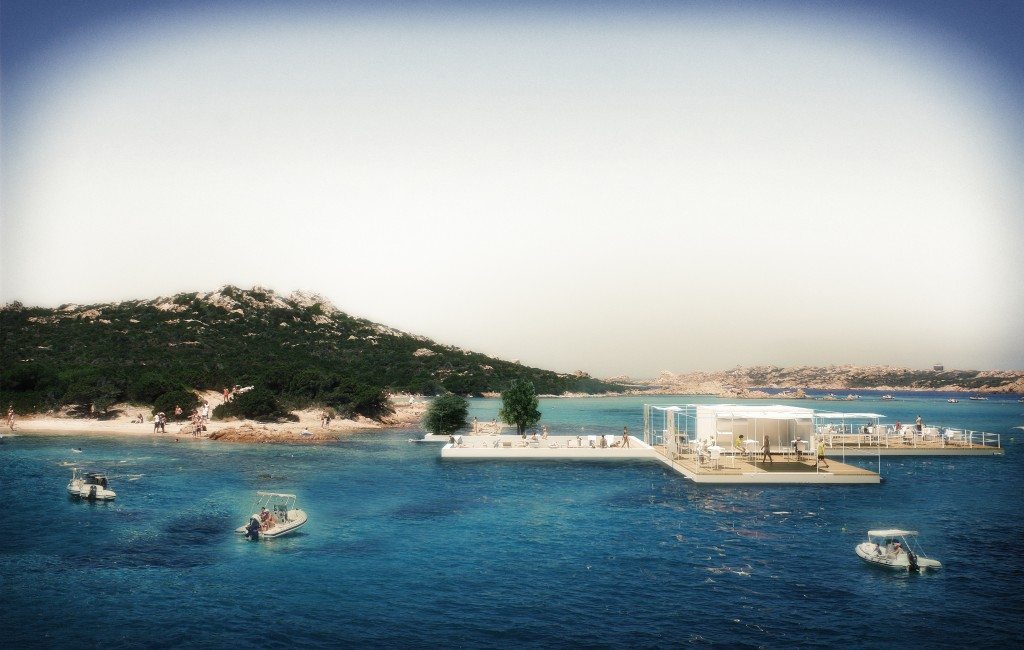
The project’s final intervention device, the “satellite port”, consists of a system of fully equipped floating platforms or pontoons, intended for different and temporary uses. Easily transportable, the platforms can be freely used according to requirements along the La Maddalena beachfront as well as in other sensitive points on the other islands. A kind of “mobile archipelago”, the satellite port is structured according to a logical connection that allows it to be simultaneously an extension of the terrace along the quay, a bridge connecting the islands and an island in itself for mooring and assistance of boats.