Images
Project
Technital (group leader), Stefano Boeri Architetti, Cooprogetti Società Cooperativa, Mate Società Cooperativa, Architect Luigi Valente, Studio Silva S.r.l., Nostoi Archeologia e Cultura, Geoprove S.r.l.
Year
2023 - ongoing
Location
Molise Region, Italy
Client
Municipality of Campodipietra (CB)
Typology
Masterplan
Services
Schematic Design, Design Development, Detailed Design, Vision
Stefano Boeri Architetti
Founding Partner: Stefano Boeri
Director: Corrado Longa
Project Leader: Stefano Ivaldi
Design team: Elena Luongo, Laura di Donfrancesco
The consortium composed of Technital (group leader), Stefano Boeri Architetti, Cooprogetti, MATE Società Cooperativa, Studio Silva S.r.l., Architect Luigi Valente, Geoprove, and Nostoi, has been entrusted with the Masterplan for the recovery of Molise’s “tratturi”.
The project aims to enhance and strengthen the tourist offer within the framework of the Molise Institutional Development Contract (CIS), with the goal of recovering the ‘tratturi’—the ancient transhumance routes, a practice recognized as UNESCO Intangible Cultural Heritage since 2019—and integrating them with the historic hamlets of Molise.
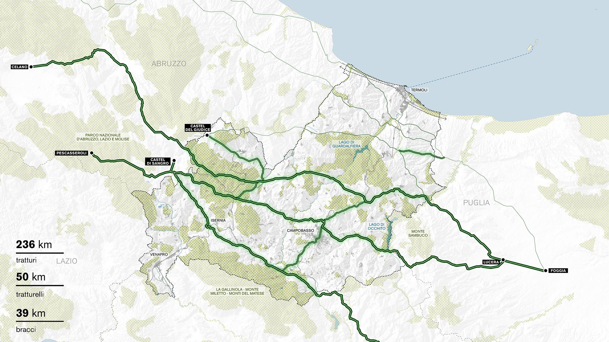
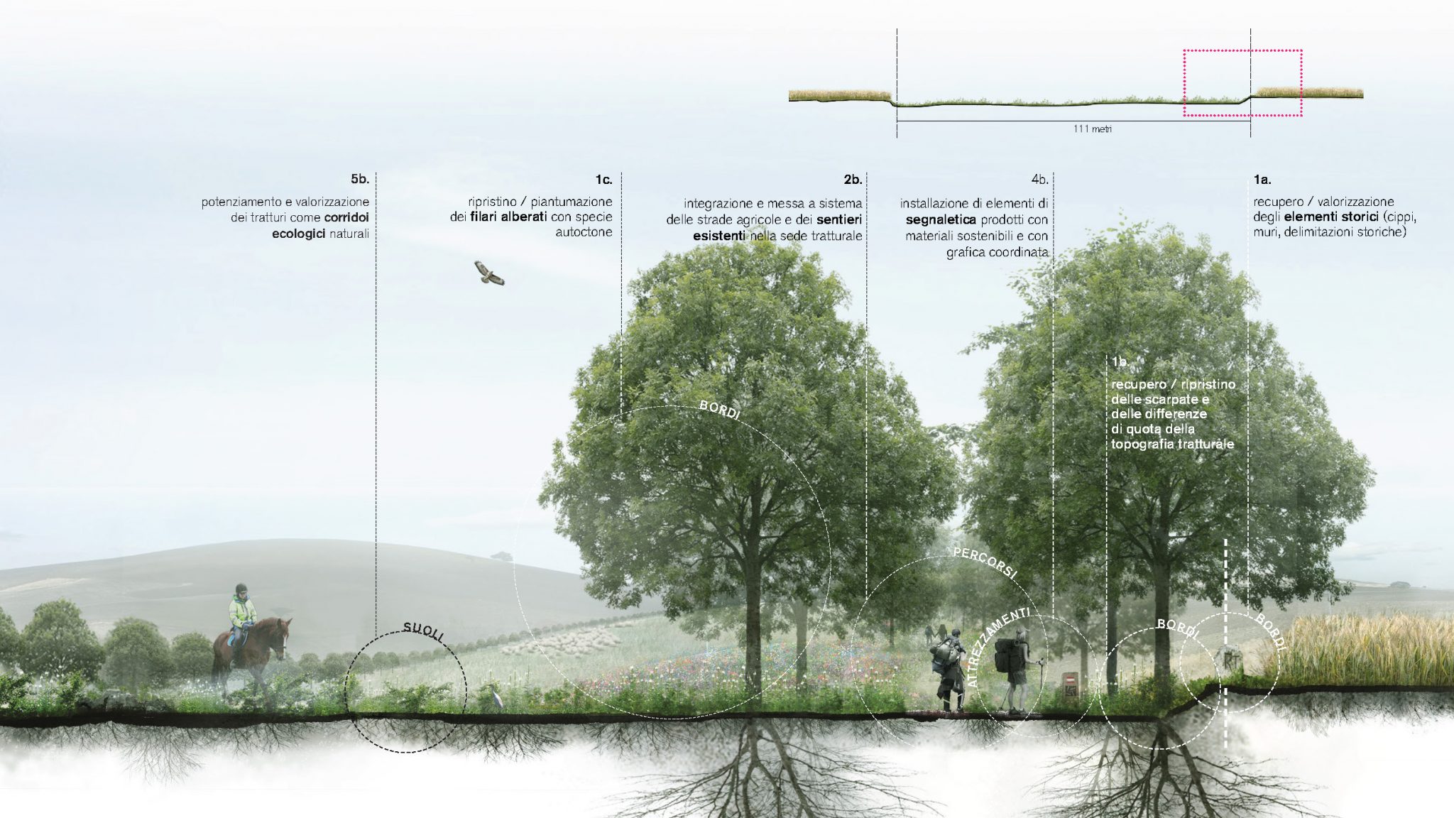
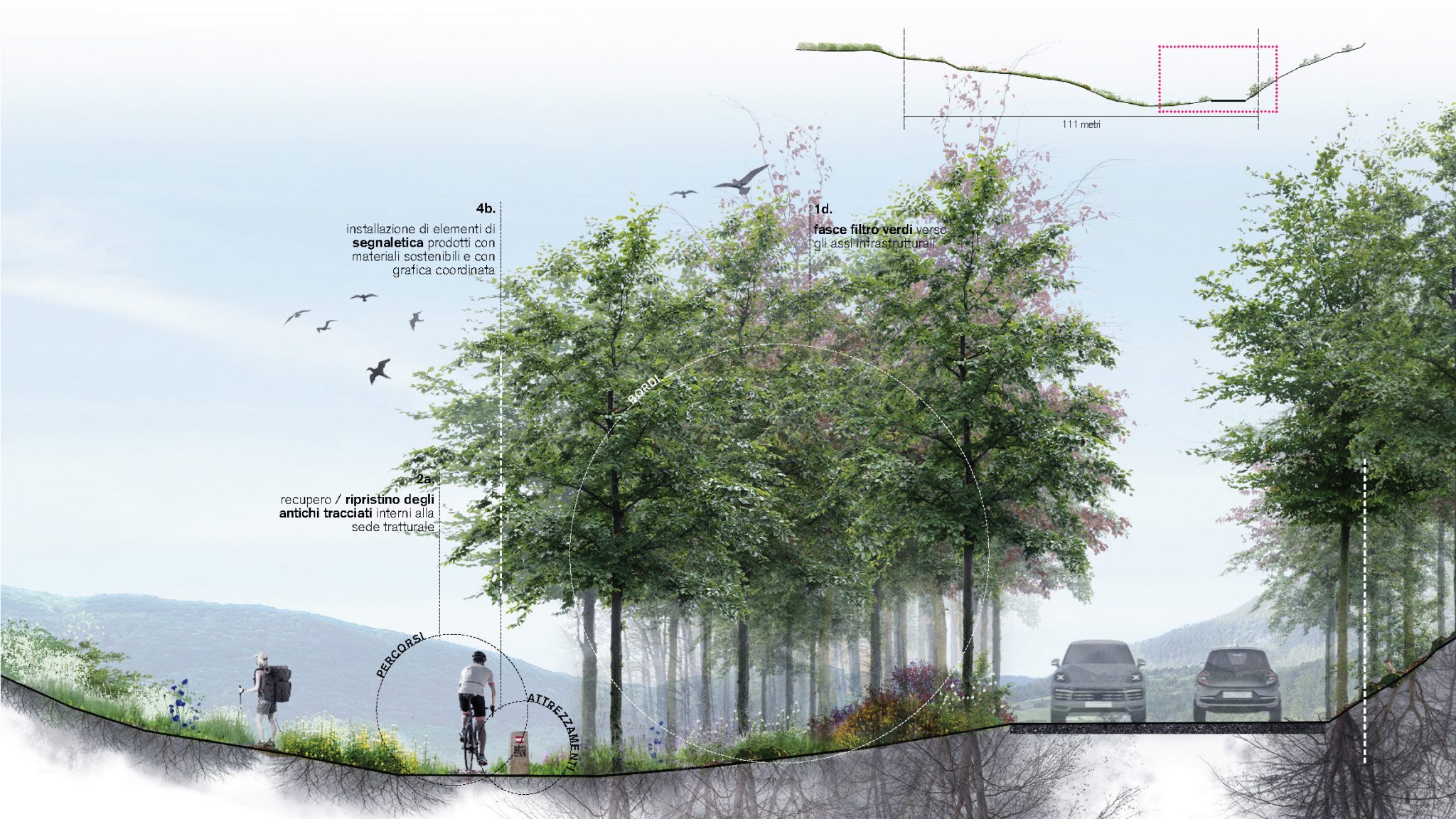
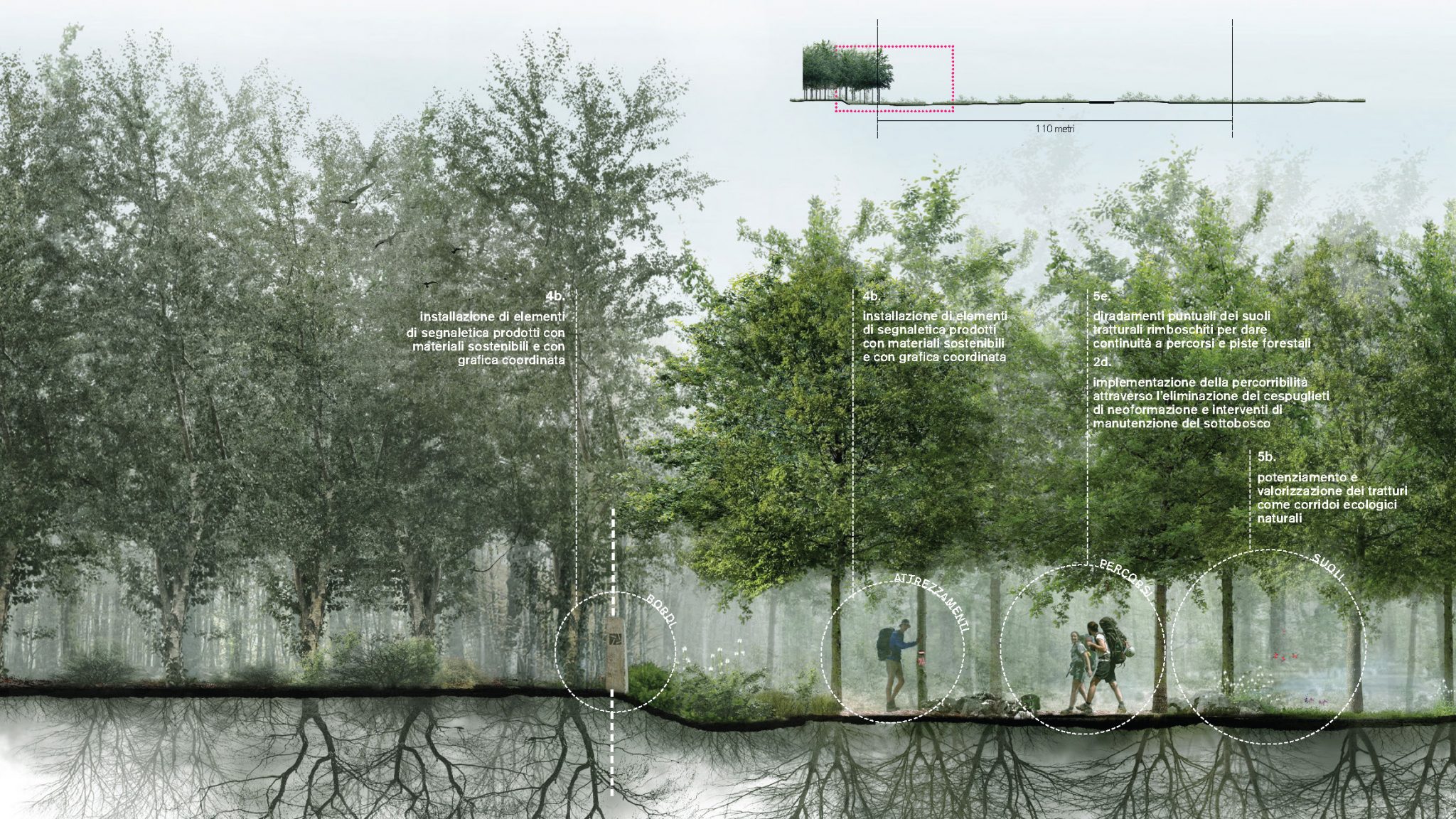
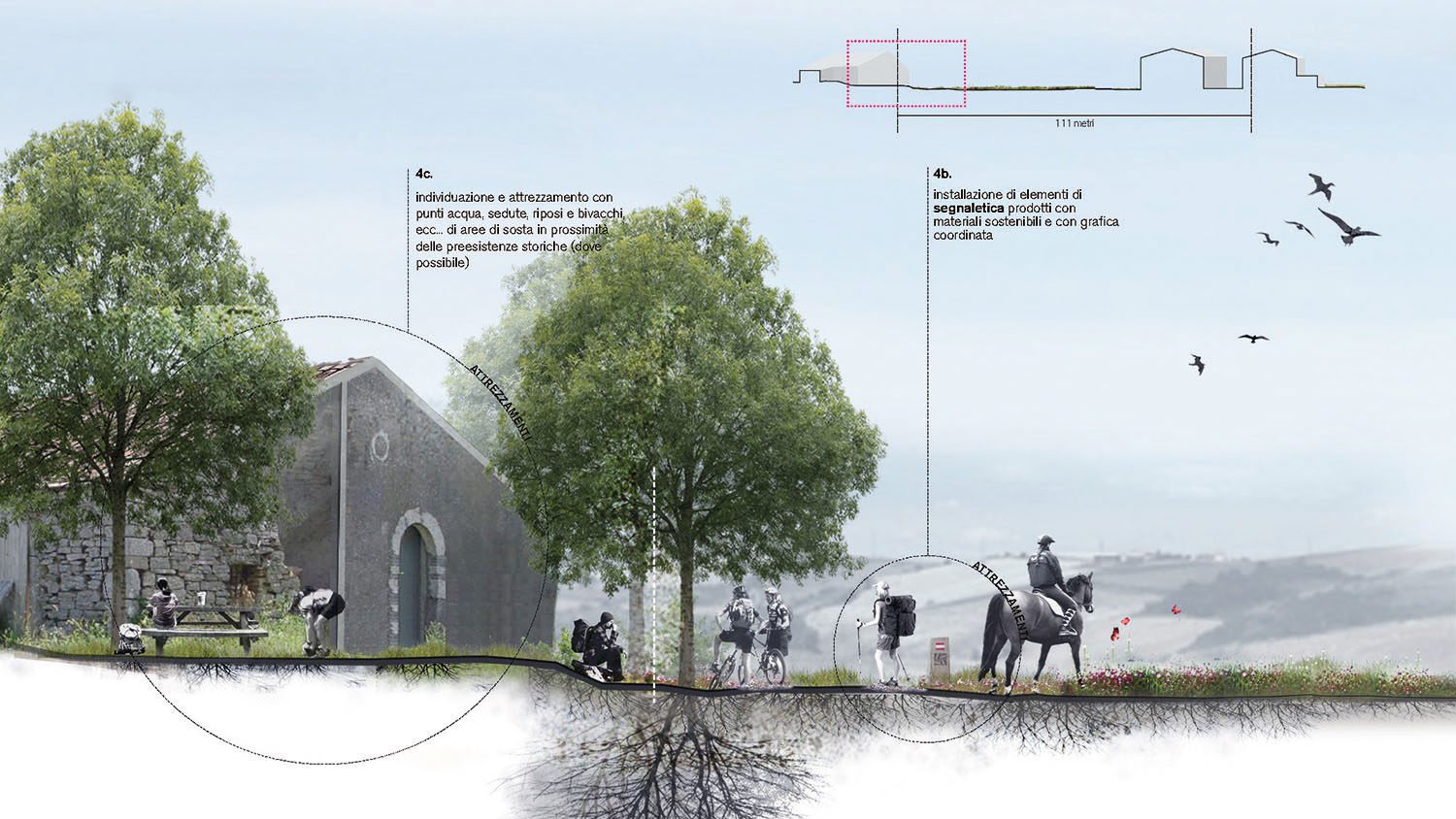
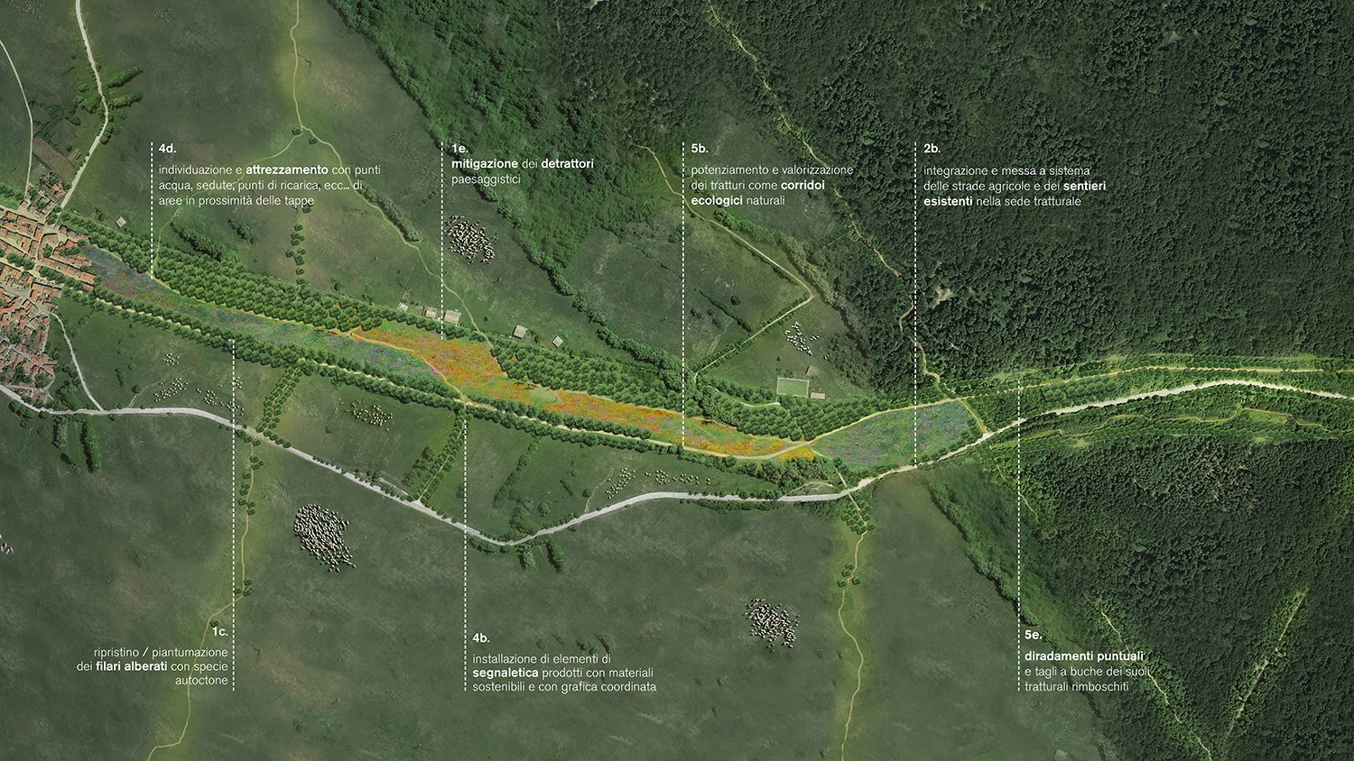
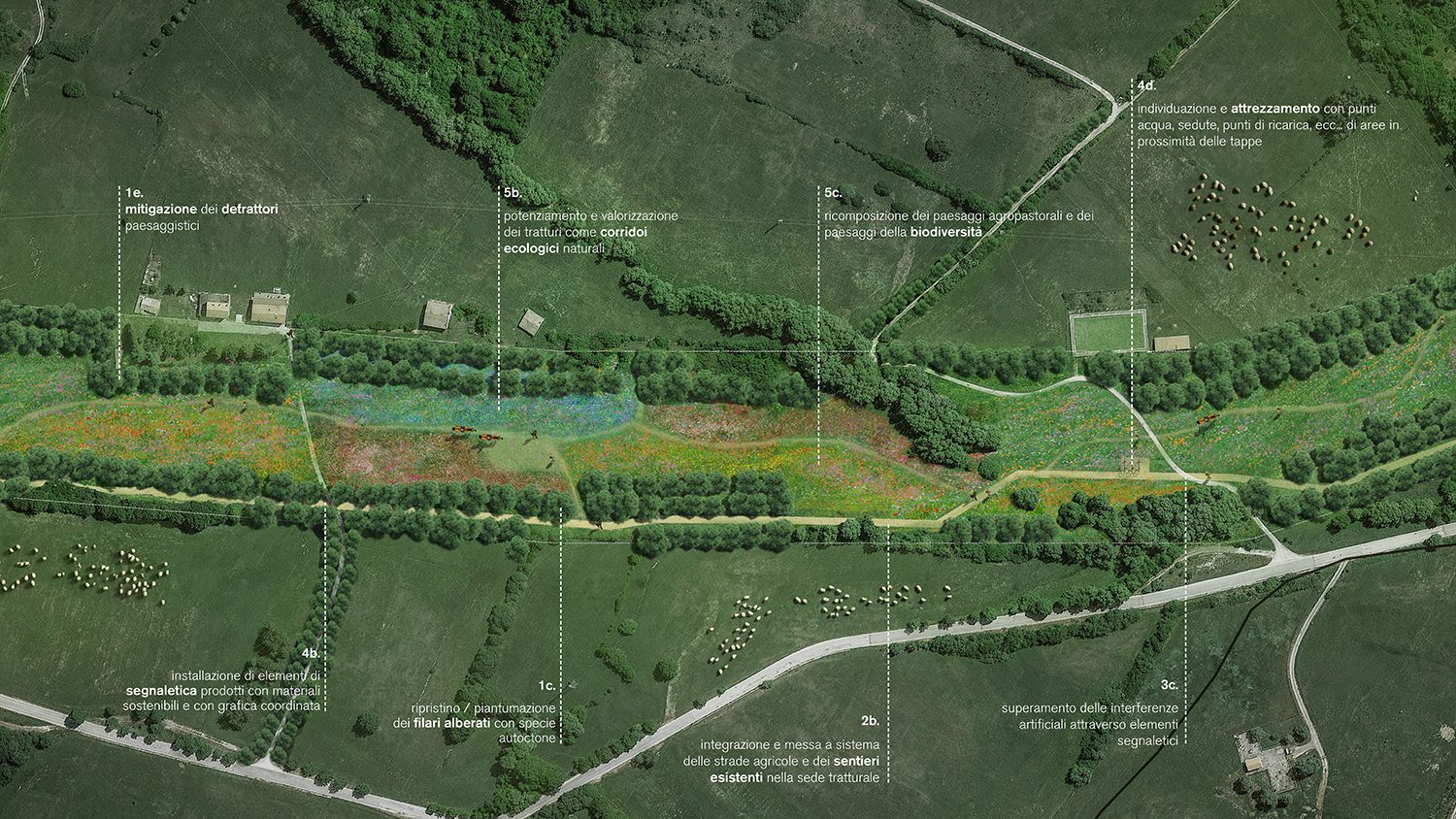
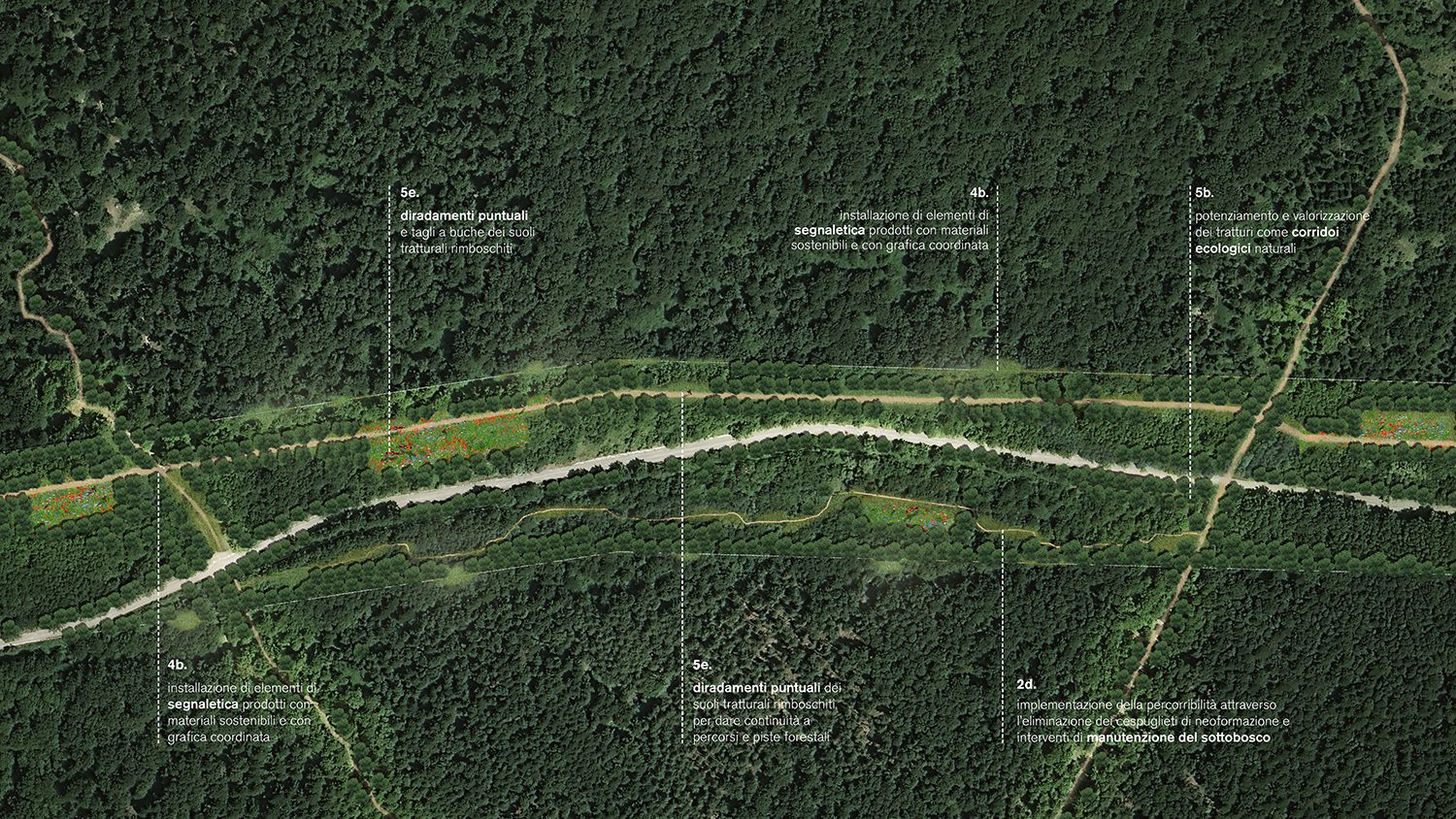
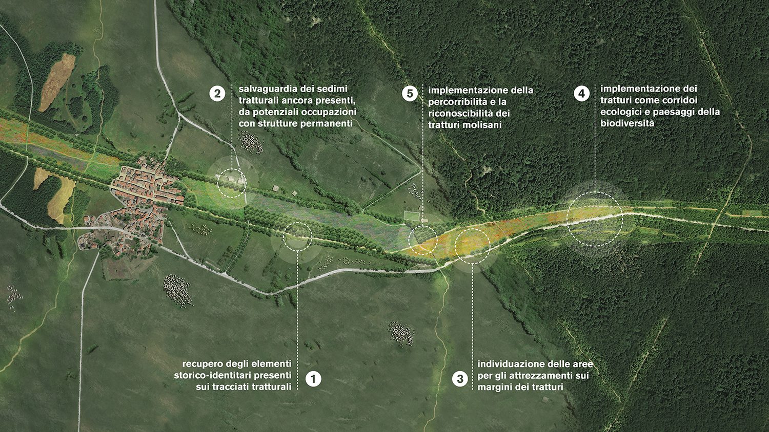
The tratturi system represents a fragment of history that spans at least seven centuries, accumulating additional stratifications over time, making it one of the most significant monuments in the economic and social history of the Abruzzo-Molise Apennines and the Tavoliere delle Puglie. Through the tratturi, herds migrated across Italian and European territories, creating natural paths characterized by unique biodiversity. The major tratturi, initially traced during migrations of large herds populating Southern Europe from the beginning of the Holocene, were later managed and expanded by the Romans to better connect urban centers. Around these routes, infrastructure such as shepherds’ huts, workshops, taverns, pastoral churches, watering troughs, and stone markers and walls to delimit boundaries began to emerge. By the XV century, the network had become so intricate that it was categorized into tratturi (main routes, approximately 110m wide), tratturelli, and bracci (secondary paths with a narrower section, connecting primary routes).
The project began with a careful analysis of the Molise territory, characterized by a fragile utilization system both from external and internal perspectives. The region has a population of approximately 300,000 inhabitants, spread across three main cities (Campobasso, Isernia, Termoli), and a diverse array of hamlets nationally recognized for their quality and uniqueness. The network of tratturi paths shows a general fragmentation and a loss of the original identity characteristics: due to land subdivision, abandonment, and artificial interruptions, most Molise tratturi paths appear incomplete or with imperceptible boundaries.
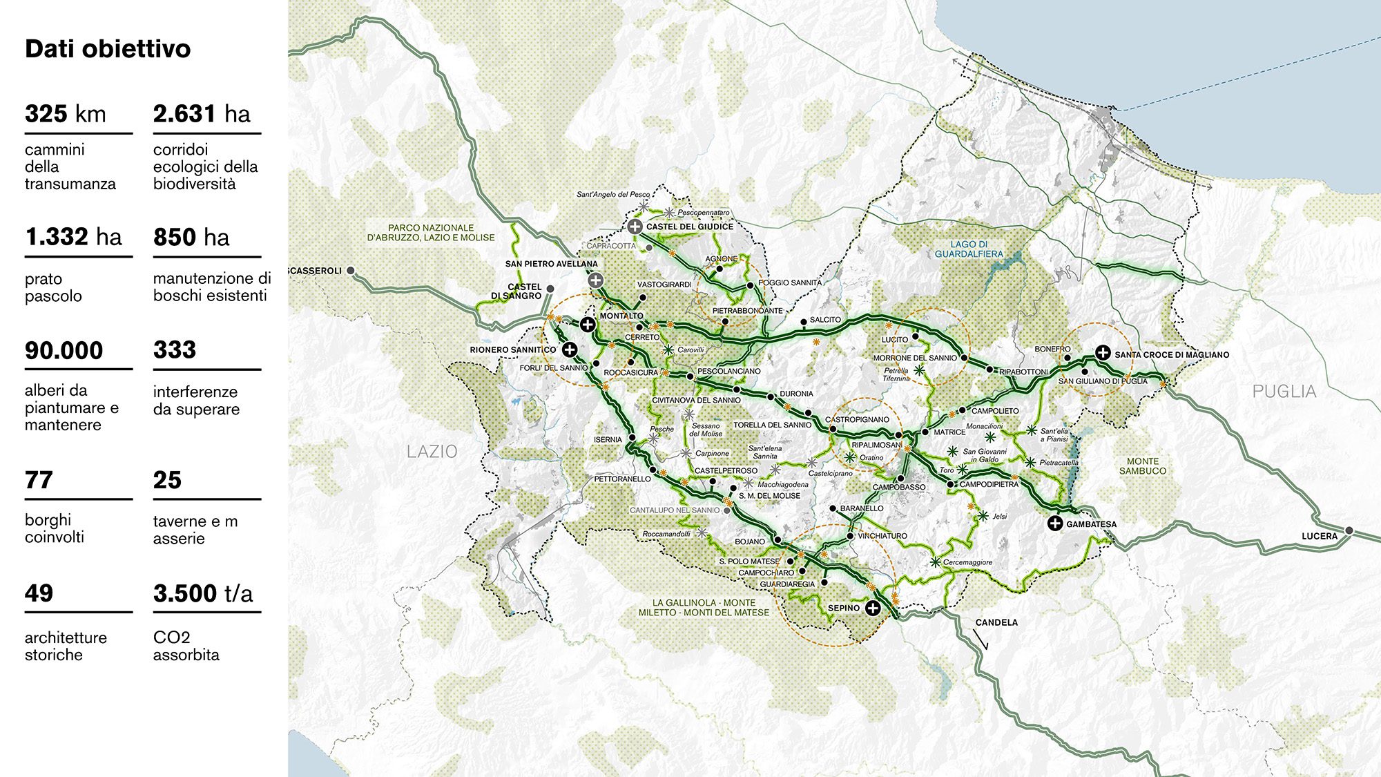
In this context, the plan envisions the integration of various territorial highlights through the regeneration of 6 tratturi, 2 bracci, and 2 tratturelli connecting Puglia, Abruzzo, and Molise, totaling 325km of restored and accessible routes. The project, developed in collaboration with a consortium of 59 Molise municipalities, involves the restoration and landscape enhancement of the historical paths of tratturi and their characteristic elements. The routes will be equipped with signage, rest points, and stages, ensuring their recognizability and usability, along with resolving historical interferences over time.
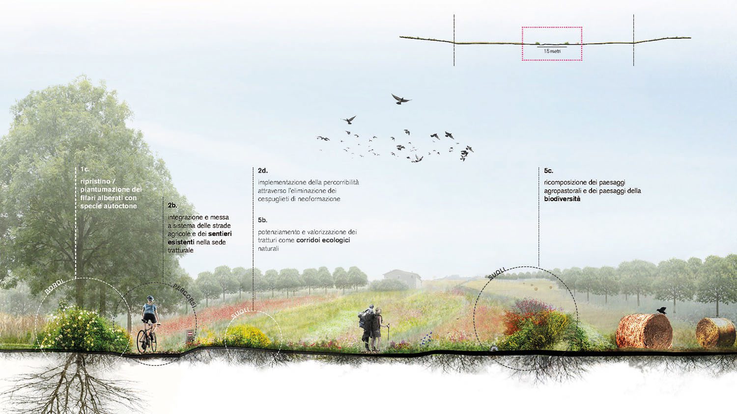
Specifically, the intervention aims to connect the paths regionally and nationally – transforming into a system of 2631 hectares of ecological corridors for biodiversity – involving the reconstruction of the routes by delineating the edges with native plant species to make the historical paths recognizable once again. The project also establishes guidelines for management, incorporating new methods of public-private co-management and revitalizing the role of the agricultural operator as a central figure in maintaining the characteristics of the tratturo over time.
The new paths unfold between 7 starting and ending “gates” (Castel del Giudice, San Pietro Avellana, Montalto, Rionero Sannitico, Sepino, Gambatesa, Santa Croce di Magliano), then branching into 36 intermediate stages, calculated based on the length of the paths and at locations of historical significance to be revitalized, covering 77 historic hamlets.
The presence of existing secondary trails, which would densify the tratturi network by forming 23 loop paths, enables the integration of the entire constellation of historic hamlets, with the goal of reactivating and reconnecting the territory.
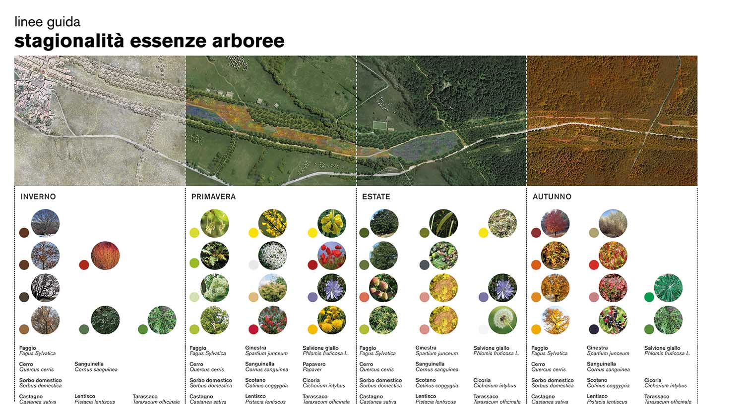
Identifying homogeneous sections of tratturi landscapes (meadow-pasture, forest, stable meadow, urban, village), the project for the recovery of the tratturi positions itself as an intervention for the regeneration and preservation of present historical-identity elements, the connection between various historic villages through accessible and recognizable pathways and the enhancement of tratturi as ecological corridors and landscapes of biodiversity, alligning with a national urban afforestation perspective in order to reactivate the territory through nature.
Project Numbers:
325 km of transhumance pathways (tratturi+tratturelli+bracci)
147 km of restored and accessible routes
2631hectares of ecological biodiversity corridors
850 hectares of maintenance for existing forests
25,000 trees preserved
40,500 new trees
263,000 hectares of polyphytic grass carpet
9,600 tons per year of CO2 absorbed
77 involved villages
36 intermediate stages
23 loop paths
49 enhanced historical and identity elements
12 restored taverns
13 restored farmhouses
8 restored springs