Images
Project
Stefano Boeri Architetti, MATE soc. Cooperativa, Studio Silva Srl, TRT srl, Avv. Gualandi, Prof. Arch.Stanghellini
Location
Padua, Italy
Year
2020 - 2022
Client
Municipality of Padua - Urbanistica Servizi Catastali e Mobilità Department
Typology
Planning
Stefano Boeri Architetti
Founding Partner: Stefano Boeri
Direttore: Corrado Longa
Project Leader: Laura Di Donfrancesco
Design team: Francesca Capicchioni, Elena Gianelloni
The main theme that guided the drafting of the new Plan of Interventions originates from a different perspective than the models of the past: the regeneration of the city of Padua, starting from the needs of citizens to improve the quality of urban life.
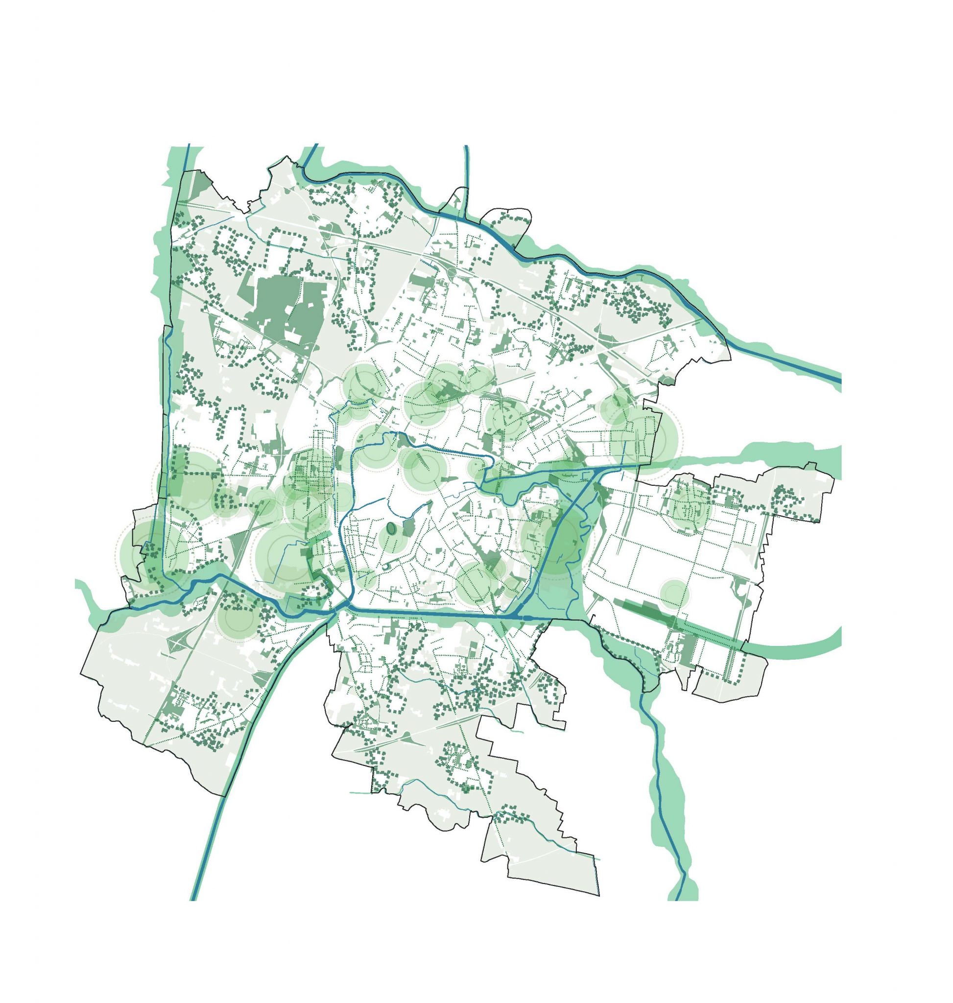
If the Urban Plan adopted in the post-war period, in fact, envisaged an expansive vision based on a star-shaped development of new neighbourhoods around the historic centre, the new Plan of Interventions, drawn up by Stefano Boeri Architetti and MATE Società Cooperativa, proposes an idea of urban form – understood not only as spatiality, but also as a way of social aggregation, of belonging – as an archipelago, where the fundamental element is the district, and its ‘sea’ is constituted by the system of green spaces and public mobility.
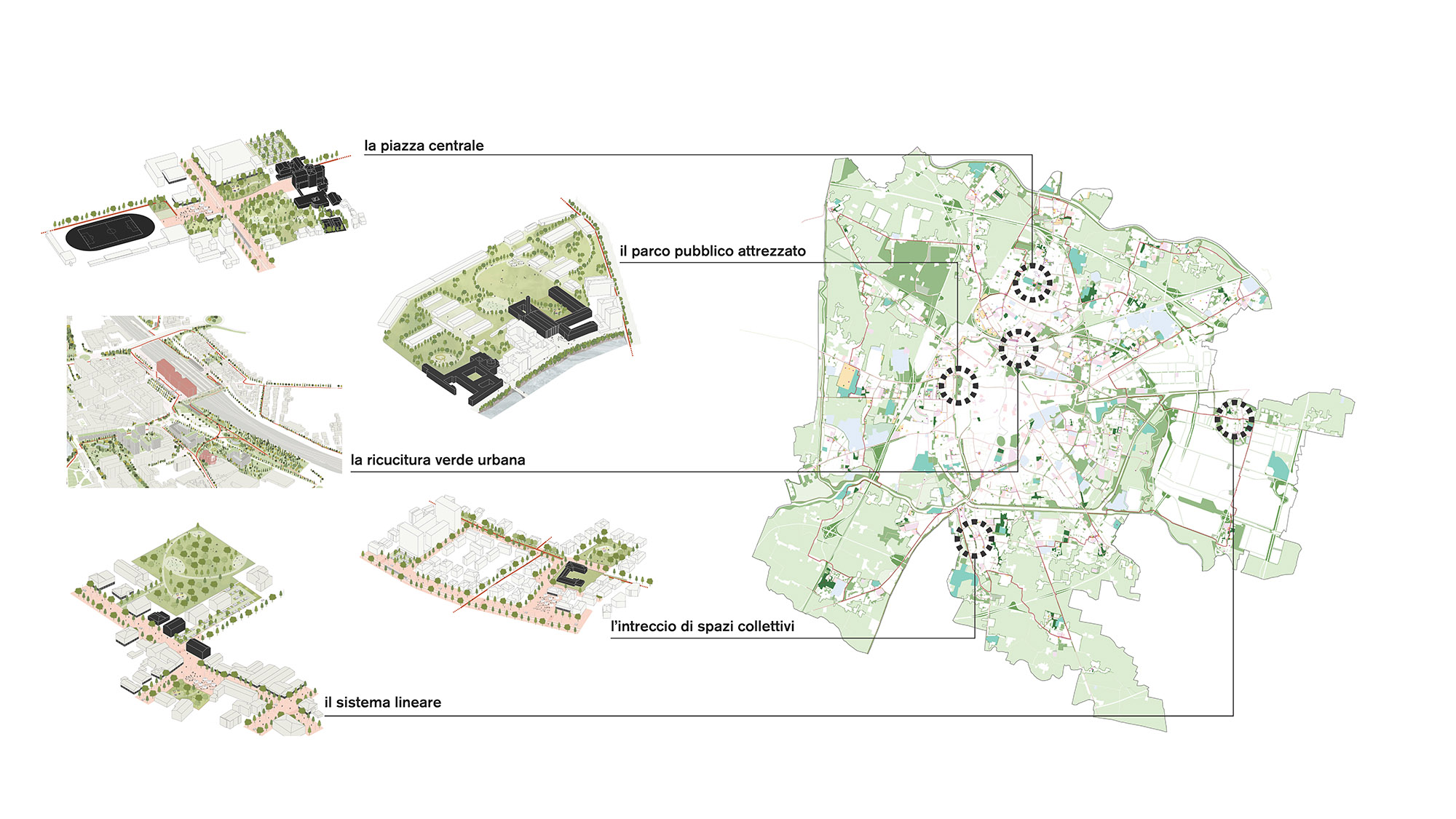
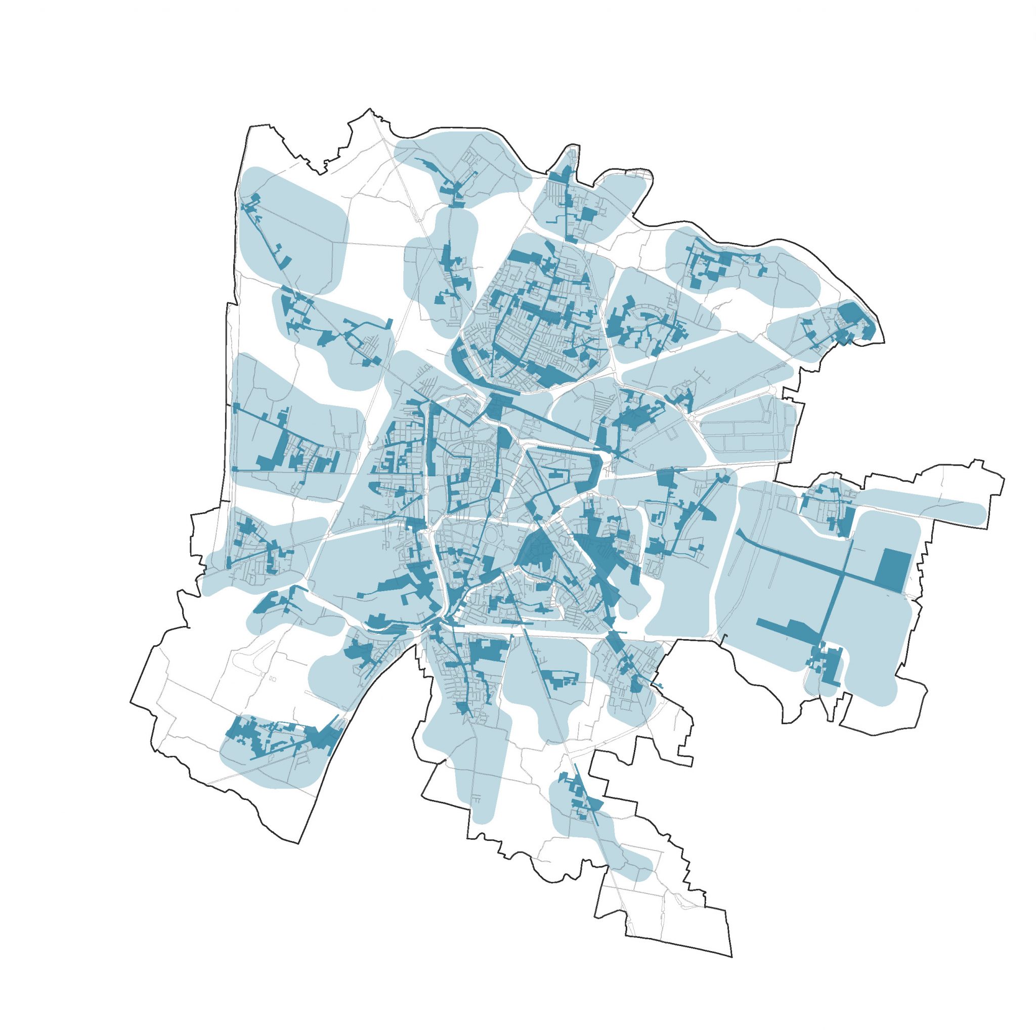
An initial analysis phase allowed the redefinition of the neighbourhoods into 33 new centralities, epicentres of the local communities not only from a geographical and spatial point of view, but also according to historical criteria, the identity of places and services, to then identify the main criticalities of each one and implement an ecological transition measured on their morphological, spatial and social characteristics.
The heart of the district is the public space, a micro-centrality that in many cases needs to be strengthened: where the problems concern the presence of disused or unused areas, the lack of aggregation spaces or the discontinuity of cycle paths, the Plan’s objectives focus on sustainable mobility, the reduction of land consumption, urban forestation, the regeneration of urban quality and citizen services. The aim is to build the ’15-minute city’, i.e. a city where public green spaces and essential services are located within a 15-minute walking distance, accessible to all citizens.
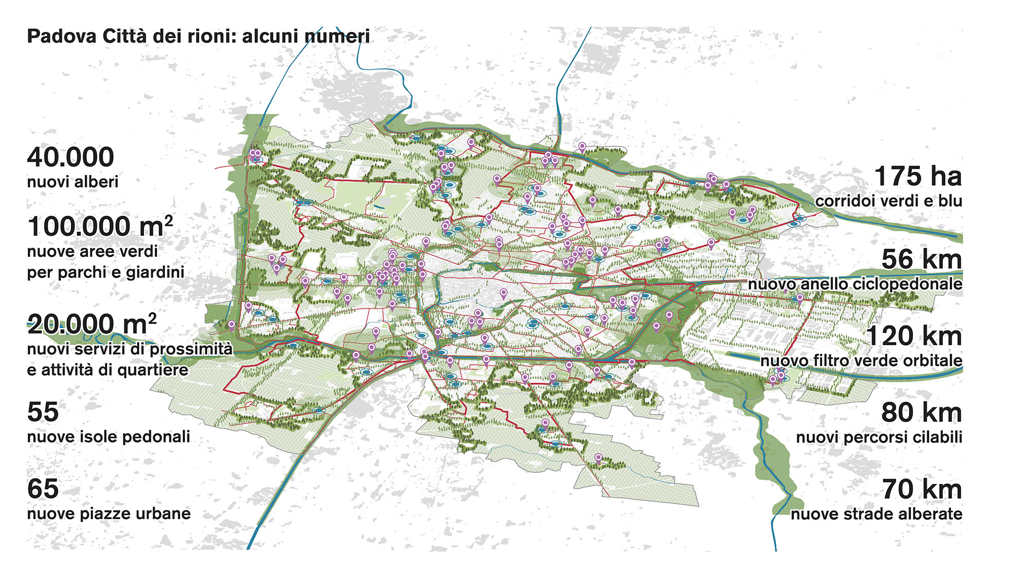
The regeneration of Padua as a city of districts starts precisely from the application of this principle, and the actions of the Plan of Interventions aim at the containment of land consumption, with a decrease of 63% compared to the current Plan and the regeneration of 550. 000 square metres of underutilised areas; to the enhancement of public transport between the districts with 23 km of new tram routes, 55 new pedestrian islands and the creation of a 56 km-long orbital cycle path system, which does not penalise public and private mobility and, on the contrary, together with forestation, clearly reconstitutes the city limits; and to the enhancement and implementation of the green system.
With the new project for public and agricultural greenery, the Plan of Interventions seeks to build the city’s future identity card. Starting from the idea of the ‘green wedges’ present in the post-war expansive configuration and never realised, the new Plan guarantees an increase in public greenery, with the enhancement and systematisation of 170 hectares of green corridors, 100,000 square metres of new parks and public gardens, and the increase of environmental quality in the urban environment with the planting of 40,000 new trees.
Overall, Padua could in the near future be endowed with 16 hectares of new green areas for public use, a new network of pedestrian and bicycle connections, and a mixed fabric of residences and services for the community of citizens. The new Plan of Interventions, therefore, with the redesigning of the network of green areas and public spaces and the mobility system – especially in the Padua Station area – does not forcibly superimpose a geography of social and physical spaces on the existing city, but moves towards a complicity and coexistence starting from the revaluation of the historical districts as community places, legacies of Padua’s important urban history, and from the needs of citizens, listened to directly through meetings, walks and bicycle routes, realised in the territories of the 10 councils.
The numbers of the Plan:
350 ha of areas returned to agriculture
188 ha of undeveloped private green areas
55 ha of existing areas to be regenerated
27 ha of land desilted and transformed into green areas
175 ha of green and blue corridors
15sqm/inhab of green areas
56 km of cycle and pedestrian ring
120 km of orbital green filter
100 ha of new public parks (+ 26%)
20 ha of new neighbourhood services
50 ha of de-impermeabilised parking areas
80 ha of new cycle routes
40 ha of shared mobility areas
55 new pedestrian areas
65 new squares
40,000 new trees
– 600 t of CO2 per year