Images
Project
Stefano Boeri Architetti
Year
2023 - ongoing
Location
Viareggio, Italy
Client
Municipality of Viareggio
Typology
Territorial Strategy, Planning
Stefano Boeri Architetti
Stefano Boeri, Corrado Longa (Director), Laura Di Don Francesco (Project Leader), Yazan Kondakji, Gabriela Mattei
Consultants: Società ENVIarea sncSTA (Ecosystem and agroforestry aspects and Strategic Environmental Assessment), STA Engineering srl (Hydraulic aspects), Geoprogetti Studio Associato (Geological aspects), Dott. Paolo Emilio Tomei (Botanical and vegetation aspects), SIMURG Ricerche snc (Socio-economic aspects), Arch. Andrea Crudeli (Historical and identity aspects), Dott.ssa Elisabetta Abela (Archaeological aspects), Atelier Principi Attivi (Participation)
The Viareggio Structural Plan, developed by Stefano Boeri Architetti and coordinated by the Municipal Technical Offices, aims to establish a medium- to long-term vision for Viareggio. This vision is centered on preserving and enhancing the city’s identity, considering both environmental and socio-economic factors. These include the ecosystem of the Migliarino San Rossore Massaciuccoli Natural Park, an area of extraordinary natural value, and the shipbuilding industry, a field in which the city is internationally renowned for its excellence.
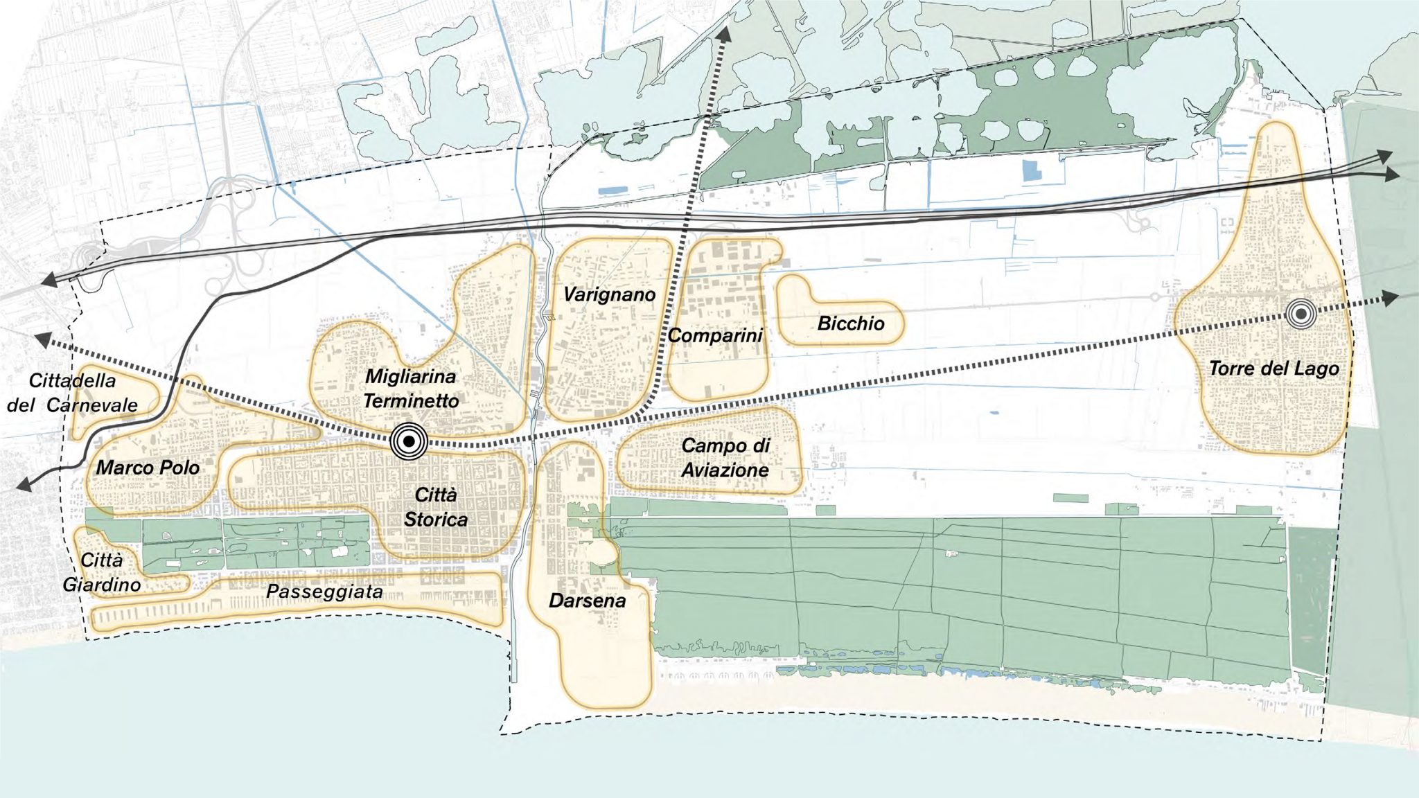
The Plan starts with the diagnostic phase of territorial analysis and involves listening to the inhabitants. It defines specific lines of action in the territory, beginning with the identification of 4 Ecologies that characterize Viareggio in its urban and environmental fabric: the Ecology of the Dense City, the Ecology of the Sea, the Ecology of the Pine Forest, and the Ecology of the Inhabited Countryside.
In alignment with these areas, the Plan outlines 4 Objectives to foster a resilient, innovative, and inclusive Viareggio, where the city center and suburbs interact within a unified, sustainable urban ecosystem, equipped with accessible, widespread, and integrated services.
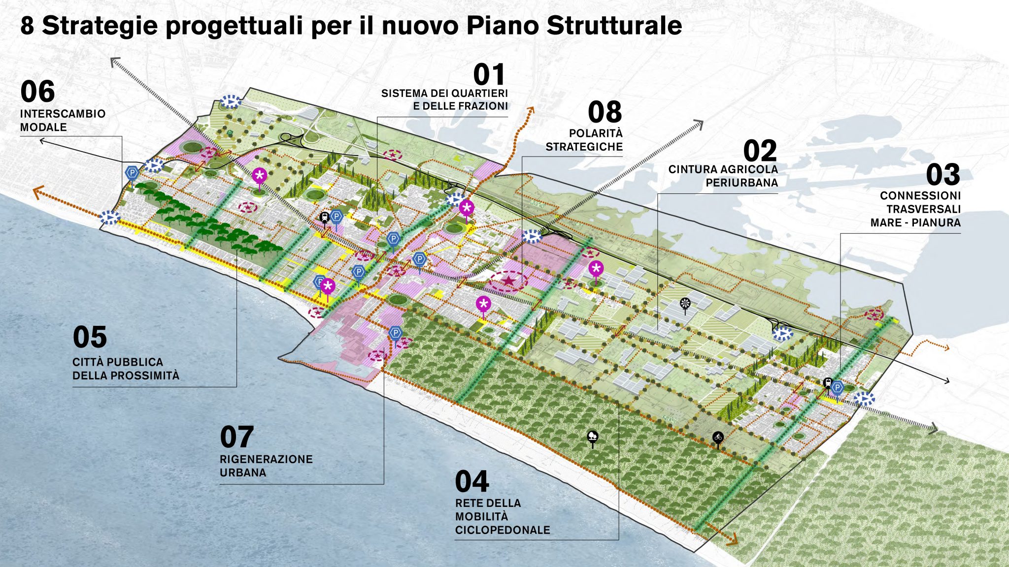
To implement the planned objectives, the Plan proposes 8 Project Strategies:
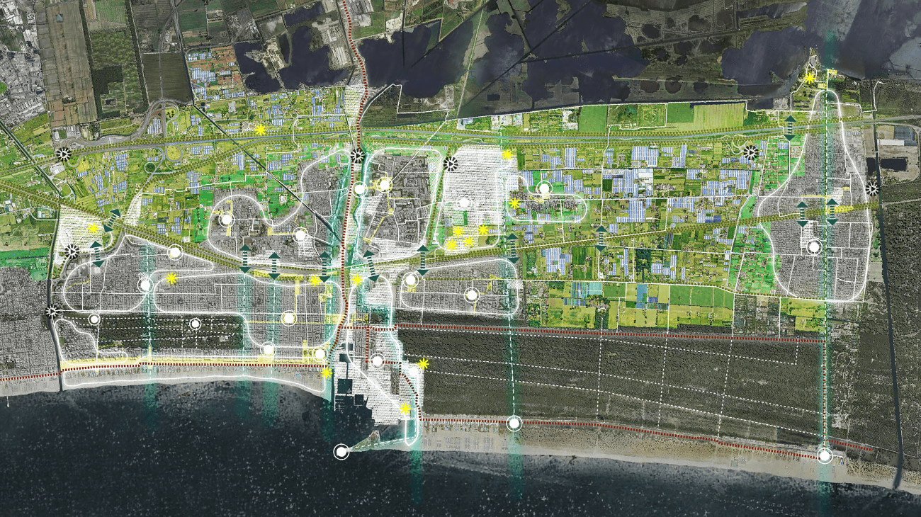
The plan is designed to enhance usability, accessibility, and livability across the system of neighborhoods and settlements. Among these, a peri-urban agricultural belt reconnects Viareggio and Torre del Lago, enhancing the rural landscape, local biodiversity, and sustainable resource management. Specifically, the Plan calls for environmental and landscape restoration and mitigation in 75 areas of intervention, as well as the introduction of 6 km of peri-urban green filters. It also includes local activities related to living, such as vegetable gardens, gardens, farmers’ markets, and educational parks.
On the one hand, in order to improve tourism and nature enjoyment, the cross-connections between the sea and the plains are being rethought, through green axes for ecological connectivity, hiking trails and cycle paths. Conversely, the enhancement of the cycle and pedestrian mobility network facilitates connectivity between key points of the public city (including schools, residential areas, services, …), with a total of 38 km of new cycle paths.
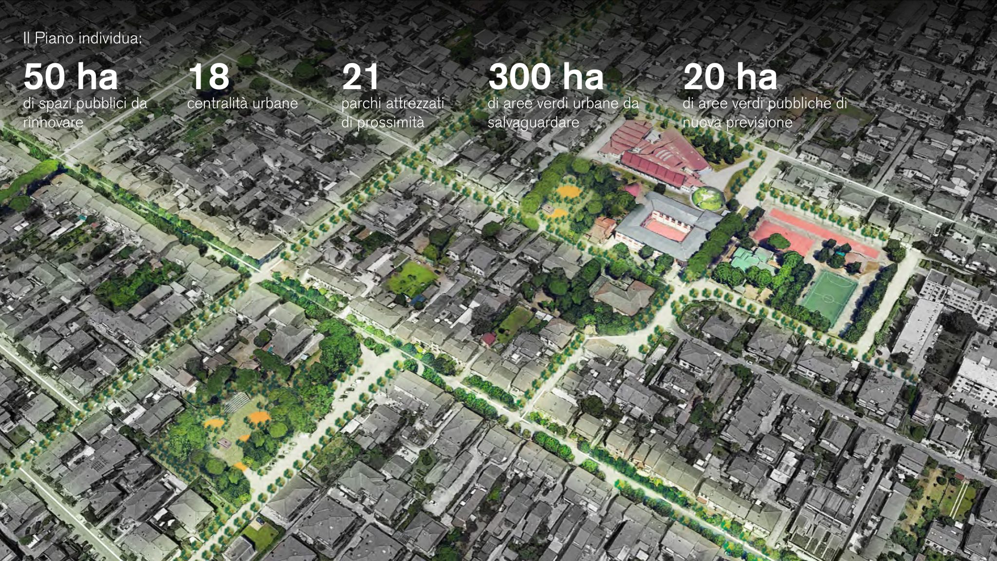
Viareggio has the opportunity to establish its urban model as a Public City of Proximity. This can be achieved through the redevelopment of the network of public spaces (covering approximately 50 hectares of intervention areas), the implementation of public green spaces (with 20 hectares of new green areas added to the existing 300 hectares, which are to be preserved), and the introduction of squares and local services in relation to the 18 urban centers.
In terms of urban mobility, to ease traffic congestion in residential areas, the modal interchange system is being enhanced with nine interchange car parks, 500 new parking spaces, and three kilometers of additional roads, improving accessibility to commercial and craft areas.
Twenty-four buildings and a total of 140 hectares have been identified for urban regeneration, promoting the redevelopment of abandoned and/or underutilized areas and implementing productive development (for innovative functions related to boating and shipbuilding), commercial/administrative, and mixed-use (for residential and public facilities).
The plan proposes a strategy for the redevelopment of the municipal territory on a supra-local scale. The proposal includes a list of 15 major projects for redevelopment. The goal of the plan is to recover and enhance urban identity, contribute to the enhancement of urban attractiveness on a territorial scale, and qualify the public city.
From a technical standpoint, the Plan aligns with the regulatory framework outlined in Regional Law 65/2014, which governs urban planning and land management tools in Tuscany. The strategy is divided into three fundamental components: the Quadro conoscitivo, based on a set of multidisciplinary territorial surveys; the Statuto del territorio, which recognizes the identity values of the territorial heritage and constitutes the prescriptive reference for future transformations; and finally, the Strategia dello sviluppo sostenibile, which outlines the possible evolutionary trajectories of the city and the urban development vision for Viareggio. The Plan establishes the framework for the future transformation of the city, delineating objectives and actions designed to exert a significant influence on urban and territorial development scenarios. It aligns Viareggio with the challenges currently facing cities—particularly coastal cities—in response to the pressing contemporary needs of ecological transition and social inclusion.